
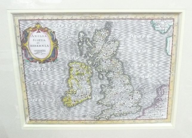
The British Isles by Mercator / Cloppenburgh
Product not available
ANGLIA SCOTIA et HIBERNIA
Above the map in the middle: BRITANNICAE
Above the map, on the right side, pagination: 31
Verso: latin text
Map of The British Isles from an uncommon, slightly larger, newly engraved(usually by P. van der Keere - latinized name Kaerius) edition of Mercator's Atlas Minor titled Atlas sive Cosmogrpahicae Medidaitiones de Fabrica mundi... , published in Amsterdam by Johaness Cloppenburgh, in 1632(just one and only latin edition)
Original copperplate engraving, recently handcoloured, map size:
18,8 x 25,5 cm.
Vergy good condition.
Reference: Koeman, Atlantes Neerlandici, 1969, V.II., pos. Me 200.