
Set of 3 maps of the Baltic Sea by Nagayev
0 PLN
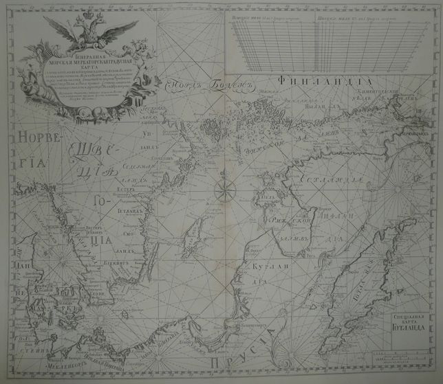
GENERALNAYA| MERKATORSKAYA GRADUSNAYA| KARTA s' pokazanïem' v' nej shiriny(m?) dliny vsekh' v' Baltiis|kom ili vostochnom Mori i v Belte mest' i raztoyanïi| mezhdu imi v' milyakh' (mashtaba po shirinam pribavlyae|mago:) po rumbam' kompasa pravago. Sochinena shvetskim' komandorom' i lots'direktorom Nils' Shtrem'krona.| Perevedeno tchshanïem' s shvetskago yazyka na Rossïis|koj i popravleno trudami flota kapitana| Alexeya Nagaeva.
Map of the whole Baltic Sea, comes from uncommon Russian Sea Atlas by Aleksei Nagayev, for the first time published in Petersbourg in 1757(there were several later issues but without changes).
Original map, XVIIIth century,after restoration, barely visible stains, and small tears on margins.
Size 52,5 x 61 cm on sheet 59,7 x79,6 cm.
Sold as a set of three maps by Nagayev.