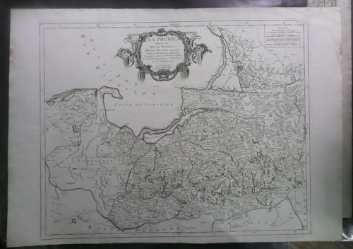
Prussia by Santini/Remondini, 1784
1990 PLN
LA PRUSSE | divisee en | PRUSSE ROYALE , et | PRUSSE DUCALE laquelle a ete | erigee en Royaume par l'Empereur | Leopold en faveur de Frederic I.Elect. | de Brandebourg couronne en Janvier 1701. | Par le Sr.ROBERT Geog. | A VENISE | Par P. Santini 1778. | Chez M.r Remondini.
In the upper right corner plate number: P. I. 48.
Map prepared by F. Santini after earlier map by G. Robert de Vaugondy, to illustrate Atlas universel..., published by Paolo Santini in 1776. This example comes from another edition of that atlas, published in 1784 by G.A. Remondini.
Original copperplate engraving, contemporary outline color.
Map size: 48,5 x 61 cm.
Reference:
Jaeger E., Prussia-Karten 1542-1810, pos. 133


