
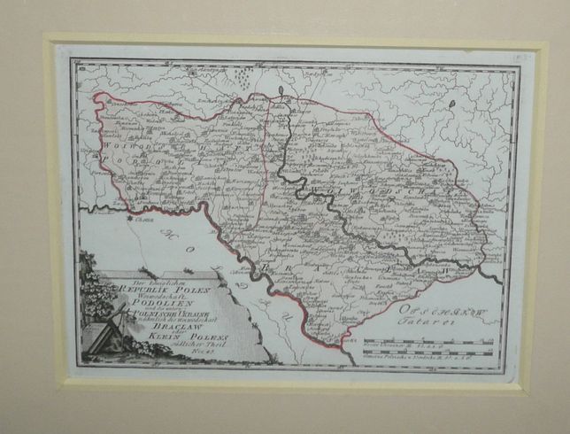
Podolien by Reilly
660 PLN
Der königlichen REPUBLIK POLEN Woiwodschaft PODOLIEN und die untere POLNISCHE UKRAINE nämlich die Woiwodschaft BRACLAW oder KLEIN POLENS südlicher Theil. Nro. 45.
Map comes from Schulplatz der funf Theil der Welt..., an atlas by F.J. Reilly published in Vienne between 1789-1806. Polish maps appeared in years 1789-1791.
Original copperplate engraving, coloured. Map size: 21,1 x 28,6 cm.