
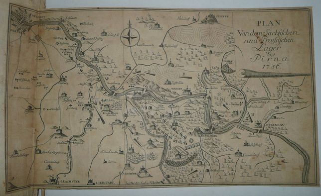
Pirna , 3rd Silesian War, 1756
660 PLN
Two separate maps glued to each other (should be easy job for paper restorer), and due to that sold as one lot.
DAS AMT | WEISSENFELS | verfertiget von | Joh: George Schreibern | in Leipzig.
Double map number in upper right margin: 70.(cancelled with double line) , on the left another number 77.
Map of surroundings of Weissenfels in Saxony, published by Johann George Schreiber in his Atlas Selectus von von allen Königreichen und Ländern der Welt, zum bequemen Gebrauch in Schulen, auf Reisen und bey dem Lesen der Zeitungen. verfertiget und in Kupffer gestochen von Johann George Schreibern in Leipzig., printed by his heirs/widow in the 2nd half of the XVIIIth century.
Original copperplate engraving with contemporary handcolor , map size : 16,4 x 23,6 cm.
Condition- paper yellowish, dirty, 2 larger stains in upper left and lower right parts of the map.
PLAN | von dem Sächsischen | und Preussischen | Lager | bey | Pirna | 1756.
Signature at the bottom : bey Marckersbach u. Hällendorf
Rare siege plan by annonymus author, from unknown book/brochure (or separately published), different state(edition) of the plan could be met in Gespräche im Reiche der Todten...,published in 1757-1759.
Original copperplate engravng, published ca 1756, map size: 18,1 x 31,2 cm.
Condition : narrow margins, paper dirty , yellowish, slightly damaged on folds.