
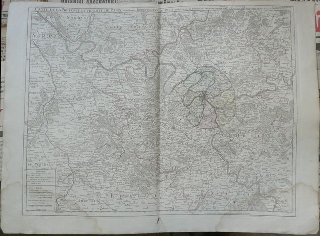
Paris and surroundings, De l`Isle / Dezauche
880 PLN
CARTE DE LA PREVOSTE ET VICOMTE DE PARIS, actuellement DEPARTEMENT DE PARIS, Divise en ses six Tribunaux. Par DEZAUCHE ,Geographe du Roi. A Paris, Chez l'Auteur Rue des Noyers pres celle des Anglois. Corrigee et considerablement Augmentee en 1782.
At the bottom, on the right side, publisher's note of the prveious plate owner and publisher:
Ph. Buache P. G. d. R. d lA. R. d. S. Gendre de l’Auteur. Avec Privilege du Roi 1782
In lower right corner, engraver's signautre: Des Rosiers fecit
Map of Paris and its surroundings , prepared and first published by Guillaume de l'Isle in the early XVIIIth century. We offer later, corrected edition(state) published by J. C. Dezauche, in his Atlas Geographique des Quatre Parties du Monde ..., Paris, after 1782.
Original copperplate engraving, contemporay handcolor.
Map size: 49,5 x 63,5 cm.
Condition: visible stains in upper and lower part of the map, wormtracks at the bottom, outside map. widoczne ślady zalania w dolnych rogach i u góry, na dole, na marginesie ślady po robaku