
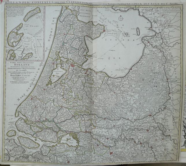
Holland by R. & J. Ottens
1440 PLN
Dutch title near left margin:
KAART VAN'T GRAAFSCHAP HOLLAND NAAUWKEURIG AFGEDEELT IN ZYNE HEEMRAADSCHAPPEN, BALJUWSCHAPPEN EN WAARDEN. nevens verſcheide andere minder aſdeelingen en onderhorige landen als mede van de HEERLYKHEIT UTRECHT en het grootste gedeelte van GELDERLANDT. te AMSTERDAM by REINIER en JOSUA OTTENS op den Nieuwen Dyk in de Wereld Kaart.
Above the map additiona latin titleł: HOLLANDIAE COMITATUS una cum ULTRAJECTINO Dommionec non Maximus Partibus GELDRIAE DUCATUS. Per. C. Specht.
Map of the Dutch region Holland (North-West part of the Netherlands), with parts of surrounding provinces, published by Reinier and Josha Ottens, after 1726.
Orignal copperplate engraving, original outline handcolor.
Map size(including title above): 52 x 58 cm.
Condition: narrow margins(upper and lower have been cut ), discoloration along the centerfold