
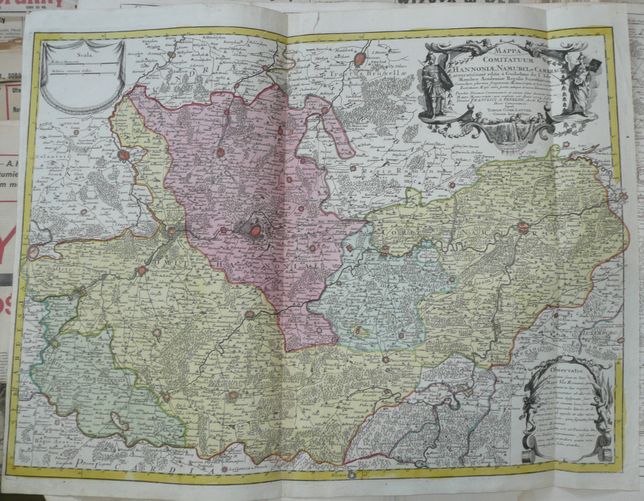
Hainaut and Namur in Belgium by Lotter
499 PLN
MAPPA COMITATUUM HANNONIAE, NAMURCI, et CAMERACI accuratiſsime edita a Guilelmo de l'Isle, Membro Academiae Regalis Scientarum... Apud. TOBIAM. CONR. LOTTER GEOGR. AUG. VIND.
Original copperplate engraving, nice contemporary handcolor.
Map size : 47,5 x 65 cm .
Good condition: two vertical folds, two minor splits in upper and lower part , barely affecting printed area, old paper squeeze in upper left part of a map, narrow left margin