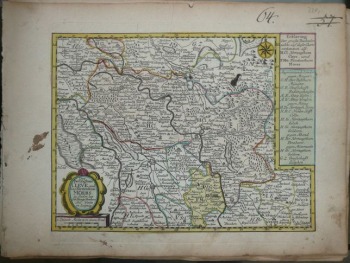
Cleve and Moers in Nordrhein-Westfallen , Shreiber
220 PLN
Das Herzogthum CLEVE, und das Fürstenthum MOERS. zu finden bey Joh. George Schreribers Seel. Wittbe in Leipzig.
Above the map in upper right part, map number written with ink: 57.(stroked out twice) , 64.
Map of the duchies of Cleve and Moers , nowadays part of Nordrhein-Westfallen published by Johann Georg Schreiber (or his heirs), Leipzig, ca 1750.
Original copperplate engraving, contemporary handcolor.
Map size(including description) : 17,6 x 23,5 cm.
Good condition: two little stains on map area, more on margins


