
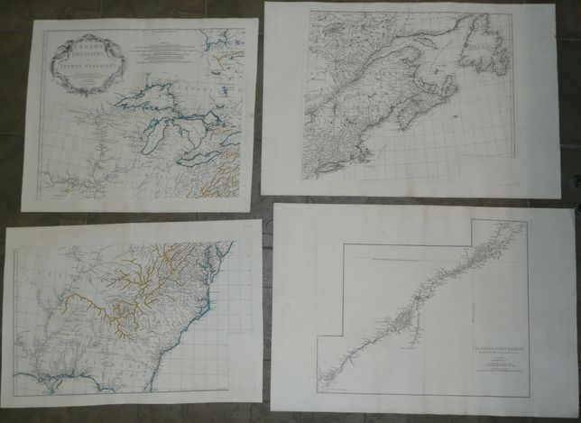
Canada, Louisiane , etc.
8000 PLN
4-sheet map of Canada, Louisiane and British Territories in North America:
CANADA LOUISIANE ET TERRES ANGLOISES PAR LE Sr. D'ANVILLE de l'Academie R.le des Inscriptions et Belles – Lettres, et de celle des Sciences de Petersbourg, Secretaire de S.A.S.M.GR LE DUC D'ORLEANS Novembre MDCCLV Sous le Privilege de l'Academie. Chez L'Auteur, aux Galleries du Louvre.
On upper left sheet, below the cartouche, on the right , its author's signature : Delafosse Sculpsit.
On lower left sheet, in lower left corner, map engraver's signature: G.De-la-Haye.
Interesting 4-sheet map of eastern part of Norh America, published by D'Anville in one his composite atlasses, Paris after 1755.
4 loose sheets that can be joined into one large map.
Left sheets with strong outline color, right ones black & white.
Each sheet is original copperplate engraving, size of each:
- upper left - 47,6 x 56 cm (sheet: 54,5 x ok. 63 cm)
-
lower left – 39 x 64 cm (sheet: 47,8 x 69,5 cm)
-
upper right – 47,5 x 57 cm (sheet: 54,5 x 80,7 cm)
-
lower right - 46,2 x 55,3 cm (sheet: 54,5 x 80,1 cm)