
Burgundy by Santini
499 PLN
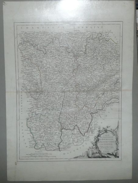
CARTE des Gouvernements de BOURGODNE , de FRANCHE COMTE et de LYONNOIS Projettee et assujettie au Ciel par M. BONNE M.tre de Mathem. a PARIS 1771.
A VENISE Par P. Santini 1777.
On the left margin, map numbers: in upper corner 19 ; at the bottom- XIX.
Map of French wine region - Burgundy published by Paolo and Francesco Santini in their Atlas Universel..., published in Venice in years 1776 – 1784. Paolo Santini copied Rigobert Bonne's map from 1771 and placed in his own atlas.
Original copperplate engraving, original outline color..
Map size: 57,5 x 43,3 cm .
Good condition: slight discoloration along the centerfold,