
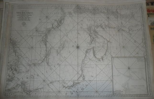
Baltic Sea by van Loon, XVIIIth cent.
8000 PLN
CARTE DE LA MER BALTIQUE Contenant les BANCS, ISLES ET COSTES Comprises entre L'ISLE DE ZELANDE er l'Extrimite du GOLFE DE FINLANDEUnder the title engraved stamp : DEPOT DE LA MARINE below Prix. trente Sols.
In upper right corner, between the frames, map number: No. 3
In lower right corner inset map: Carte de la RADE de DANZTIK.
Above the frame, to the left from the inset map, engraver's signature: H. Van loon Sculp.
Map engraved by Hermana van Loon to first volume of Paris edition of Le Neptune Francois , atlas first published by Alexis-Hubert Jaillot in 1693. In XVIIIth century the original plates had been augmmented and used for another edition of the atlas. This map comes from later, probably from the second half of the XVIIIth century, editon of Le Neptune Francois.
Original copperplate engraving. Size 60,8 x 88,8 cm.
Good condition: upper margin enlarged, small tears on margins (reinforced) and one in the middle of map