
Alsatia and Lorraine by Santini
499 PLN
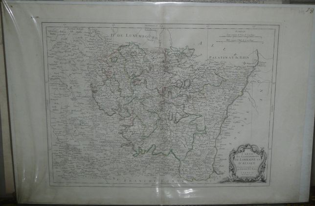
CARTE du Gouvernements DE LORRAINE ET D'ALSACE Projettee et assujettie au Ciel par M. BONNE M.e de Mathem.
A VENISE Par P. Santini 1777.
Above the map, map numbers: on the left side XVIII ; in the right corner- 18
Map of Alsatia and Lorraine published by Paolo and Francesco Santinich in their Atlas Universel..., published in Venice in years 1776 – 1784. Paolo Santini copied earlier map by Rigobert Bonne.
Original copperplate engraving, contemporary outline color.
Map size: 43 x 57,2 cm .
Good condition: slight discoloratio along the centerfold.