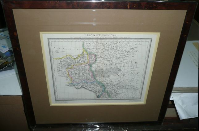
Alabern-Kingdom of Poland, 1830s

1220 PLN


Above the map:
REINO DE POLONIA | o sea la parte unida ala Rusia por el repartimiento de 1795 que conserva el nombre de aquel antiqup reino.

Balow the map, in the middle , no signature (like on other known state)only : Longitud oriental de Madrid.

Map of the Kingdom of Poland, created 1815 , parto of Russian Empire, comes from Atlas geografico universal , prepared by Pablo and Ramon Alabern and Domenic Estruc, published in Barcelona ca 1834 .

Original lithography, original outline color.

Print size 27 x 34,9 cm, framed   (54 x 58 cm).

Contact data
Send a message

Warning: unlink(tmp/sec/0.64331000 1768034184.key): No such file or directory in /home/wankosmo/www/box/ext/mod_form_fast_footer.php on line 61

Warning: unlink(tmp/sec/0.82722500 1768034329.key): No such file or directory in /home/wankosmo/www/box/ext/mod_form_fast_footer.php on line 61

Warning: unlink(tmp/sec/0.97764700 1768034329.key): No such file or directory in /home/wankosmo/www/box/ext/mod_form_fast_footer.php on line 61

Warning: unlink(tmp/sec/0.15690400 1768034099.key): No such file or directory in /home/wankosmo/www/box/ext/mod_form_fast_footer.php on line 61

CloseThis website uses cookies collected for statistical purposes and used for the proper operation of the website. Conditions for storage or access cookies, you can change your browser settings - failure to change the browser settings, you consent to the saving.