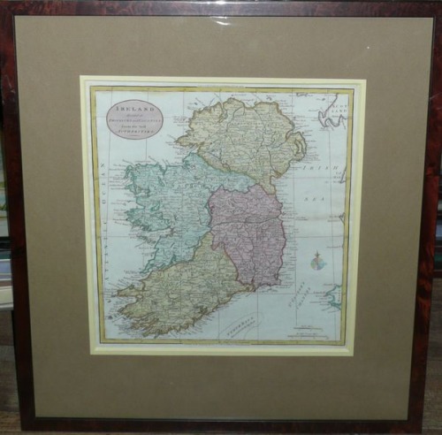
Irlandia, W. Guthrie, 1785 r.
1330 PLN
IRELAND divided in PROVINCES and COUNTIES from the beſt Authorities.
Nad mapą informacja o dziele, w którym zamieszczono mapę: Engraved for Guthries new Syſtem of Geography
Pod mapą nota wydawnicza: Publish’d as the Act directs January 1ſt 1785 by C.Dilly & G. Robinſon London.
Mapa zamieszczona w kolejnym wydaniu A new System of Geography W. Guthrie, Londyn , 1785 r.
Oryginalny miedzioryt , XVIII w., ręcznie kolorowany, oprawiony.
Wymiar mapy: 36,6 x 33,7 cm .


